R S & Intelligence Satellites of the Indian Military
- Oct 28, 2021
- 3 min read
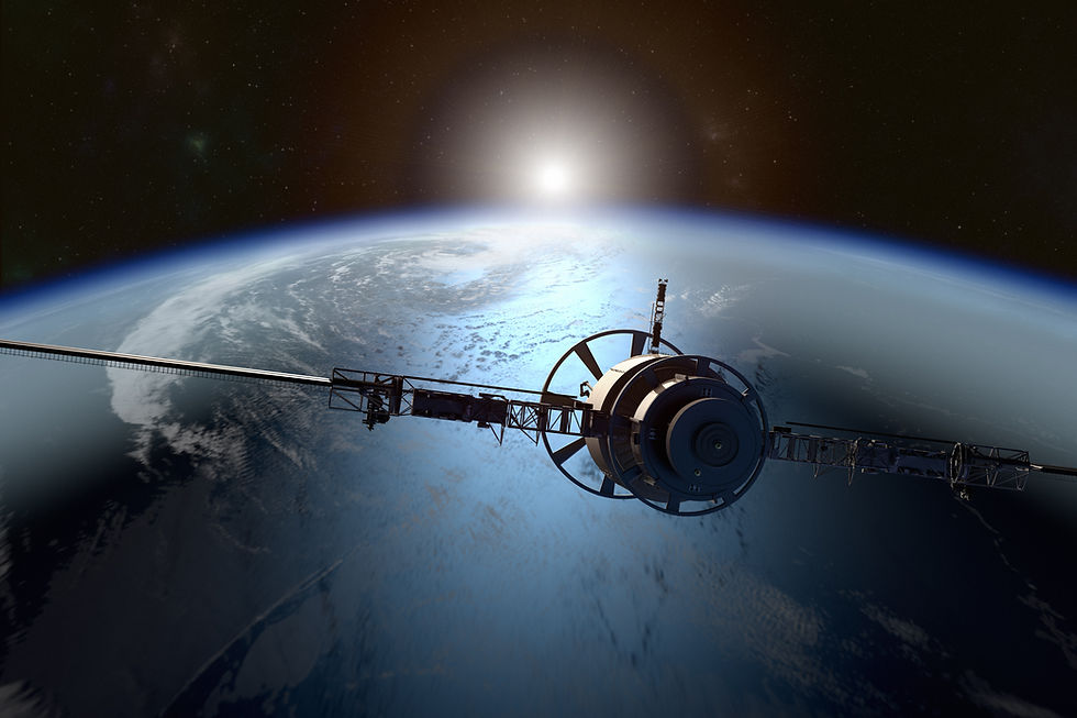
As per Military Balance 2018 (IISS 2018) India has three reconnaissance satellites. 1 Cartosat 2C and 2 RISAT. In addition the EMISAT has been launched on 01 April that makes it four satellites for Reconnaissance, Surveillance and Intelligence purposes.
Cartosat-2 Series Satellite
Cartosat-2 Series Satellite is the primary satellite carried by PSLV-C40. This remote sensing satellite is similar in configuration to earlier satellites in the series and is intended to augment data services to the users.
The imagery sent by satellite will be useful for cartographic applications, urban and rural applications, coastal land use and regulation, utility management like road network monitoring, water distribution, creation of land use maps, change detection to bring out geographical and manmade features and various other Land Information System (LIS) as well as Geographical Information System (GIS) applications.
The Cartosat 2 series has a lift off mass of 713.2 kgs, is powered by Batteries: 36AH X 2 Lithium-Ion Power :986W EOL with 3 axis stabilised mission. Operating on S Band the onboard data storage is Panchromatic camera with 0.65m resolution 4 Bands Multispectral camera with 2.0 m with a swath of 10 km.
It operates at 505 Kms Polar Sun Synchronous orbit with an inclination of 97.46 deg and has a life of 5 years till 2022.
RISAT-1
Radar Satellite-1 (RISAT-1) is a state of the art Microwave Remote Sensing Satellite carrying a Synthetic Aperture Radar (SAR) Payload operating in C-band (5.35 GHz), which enables imaging of the surface features during both day and night under all weather conditions.
Active Microwave Remote Sensing provides cloud penetration and day-night imaging capability. These unique characteristics of C-band (5.35GHz) Synthetic Aperture Radar enable applications in agriculture, particularly paddy monitoring in kharif season and management of natural disasters like flood and cyclone.
The RISAT has a mass of 1858 kgs and operates in the Circular Polar Sun Synchronous with 14 Orbits per day and repetivity of 25 days. The Satellite is 3-axis body stabilised using Reaction Wheels, Magnetic Torquers and Hydrazine Thrusters.
The life of the satellite has been extended as it was for 5 years from launch in April 2012
Images from RISAT 1 were reportedly used for the land based surgical strikes in 2016 as well as the aerial strikes on the Jaish e Mohammad camp on 26 February 2019.
https://www.firstpost.com/tech/science/isro-to-launch-five-military-satellites-in-2019-to-boost-strategic-assets-in-space-6385541.html
RISAT-2
RISAT-2 is a Radar Imaging Satellite with all weather capability to take images of the earth. This Satellite enhances ISRO's capability for Disaster Management applications.
The altitude for operation is 550 kms and orbit period of 90 minutes with a mass of 300 kgs.
EMISAT
EMISAT is a satellite built around ISRO’s Mini Satellite-2 bus weighing about 436 kg. The satellite was successfully placed in its intended sun-synchronous polar orbit of 748 km height by PSLV-C45 on April 01, 2019. The satellite is intended for electromagnetic spectrum measurement.
Huma Siddiqui writes in Financial Express on March 29, 2019 that the EMISAT is based on ISRO’s Indian Mini Satellite – 2 (IMS-2) bus platform. The role is to measure the electromagnetic spectrum and to read the location of radar emitters, both ground and naval.
Sidiqui quotes Ratan Shrivastava, Advisor, Space Division, FICCI, “The EMISAT has been developed for monitoring radar network by India. EMISAT is a small satellite weighing approximately 436 kgs and developed by DRDO (DLRL Hyderabad) under Project KAUTILYA.”
“It is an ELINT satellite based on IMS2 Bus (Indian Mini Satellite Bus series) which can have a maximum launch weight of 450Kgs with a payload no more than 200kgs. It shares the same Bus architecture as the HySIS satellite launched in November 2018. It is likely to be placed in an elliptical orbit in order to optimize the dwell time, for a required area under observation,” Shrivastava explains as per Siddique.


Comments